Syria FM in Saudi Arabia on maiden trip as new rulers reset regional ties
 02 January 2025
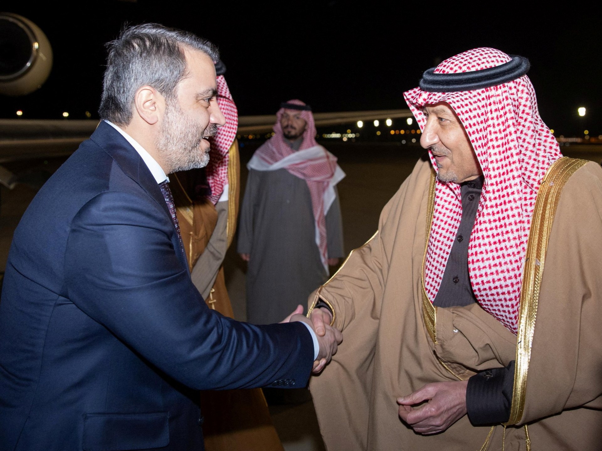

Syria’s top diplomat says he hopes to open a “new, bright page” with Saudi Arabia upon arriving in the kingdom, the first foreign visit for Syria’s new rulers.
The visit, which began late on Wednesday, came less than a month after former Syrian President Bashar al-Assad was ousted by rebel forces on December 8.
“I have just arrived in the sisterly Kingdom of Saudi Arabia, accompanied by the Minister of Defence Murhaf Abu Qasra and the Head of the General Intelligence Service Anas Khattab,” Asaad al-Shaibani posted on X.
“Through this first visit in the history of Free Syria, we aspire to open a new, bright page in Syrian-Saudi relations that befits the long shared history between the two countries,” he added.

Al-Shaibani was appointed foreign minister on December 21 by Syria’s interim government, becoming the country’s first top diplomat since al-Assad’s overthrow.
Advertisement
Earlier on Wednesday, Syrian state media said the delegation was visiting the kingdom “at the invitation of the Saudi foreign minister”.
A statement shared by Syria’s Foreign Ministry said Saudi Arabia’s Vice Minister of Foreign Affairs Waleed bin Abdulkarim El Khereiji received the delegation at the international airport in Riyadh.
The Syrian delegation includes Defence Minister Murhaf Abu Qasra and General Intelligence Chief Anas Khattab, underscoring the visit’s diplomatic and strategic significance.
In an exclusive interview with Al Jazeera aired on Tuesday, al-Shaibani called for the lifting of all Western sanctions on Syria as he detailed the new administration’s plans for the country’s future.
Adam Clements, a former US diplomat and Pentagon official, said Saudi Arabia is working to establish strong ties with Syria as Iran loses its influence over the country.
“I think this is very significant,” he told Al Jazeera on Thursday. He said that from a “diplomatic standpoint”, Riyadh wants to forge stronger ties with the new Syrian administration.
“Saudi Arabia would have a big role as well … at the outset of construction and reconstruction. Syria is very dependent on Iran for oil and fuel, and so I think Gulf States could also support that as well,” he said.
In an interview with Saudi-owned Al Arabiya television on Sunday, Syria’s de facto leader Ahmed al-Sharaa, also referred to as Abu Mohammed al-Julani said Riyadh “will certainly have a large role in Syria’s future”, pointing to “a big investment opportunity for all neighbouring countries”.
Advertisement
Al-Sharaa heads the Hayat Tahrir al-Sham (HTS) group that led the rebel offensive that ousted al-Assad.
Syria’s economy and infrastructure have been devastated by more than 13 years of civil war that began with a crackdown on pro-democracy protests in 2011.
Saudi Arabia severed ties with al-Assad’s government in 2012 and backed Syrian rebels seeking to overthrow him early in the country’s civil war. In 2023, the Arab League readmitted Syria after more than a decade of suspension.
Related News

Georgia court disqualifies prosecutor Fani Willis from Trump election case

Brazil’s former defence minister arrested in attempted coup probe

Azerbaijan probe finds Russian missile caused deadly crash, reports say